
Straubing
Schloßbrücke, 94315 Straubing, Deutschland
Schloßbrücke Straubing | Danube & Old Town
The Schloßbrücke in Straubing is a place where city history, river landscape, and everyday paths overlap in a very compact way. As an inner Danube bridge, it connects the Old Town with the inland island Gstütt and is located exactly at the junction where Straubing's historic core, the riverbank zone, and the green space of the Danube meet. This is particularly appealing to visitors because here one not only crosses a bridge but enters a cityscape characterized by the ducal castle, the Danube, ship docks, park-like areas, and striking sightlines. The location at the junction of Schloßbrücke/Uferstraße/Stadtgraben/Schloßplatz also makes the area an important reference point in the inner-city traffic network. Those experiencing Straubing on foot, by bike, or as a city walk often pass by this spot, as it sensibly connects the historic Old Town with the river areas and the paths along the Danube. This blend of function and atmosphere makes the Schloßbrücke an urbanistically interesting, photogenic, and important place for orientation in Straubing. ([de.wikipedia.org](https://de.wikipedia.org/wiki/Schlo%C3%9Fbr%C3%BCcke_%28Straubing%29?utm_source=openai))
Location between Old Town, Uferstraße, and Gstütt
The special quality of the Schloßbrücke lies in its location. It forms the direct connection between the Straubing Old Town and the island Gstütt, which is perceived as a nature-oriented yet urban-integrated area. In the vicinity of the bridge, several axes converge with Schloßplatz, Stadtgraben, and Uferstraße, and it is precisely there that the junction in traffic planning has been described as a shifted developed area with turning lanes. For pedestrians and cyclists, fords over the arms of the Schloßbrücke, Stadtgraben, and Uferstraße are available, making the location relevant not only for car traffic but also for city walks. Particularly interesting is that the area lies within the sightlines of important historical buildings: Urban planning documents explicitly refer to sight relationships from the Schloßbrücke to the towers of St. Peter's Church. This makes it clear that the bridge is not merely a technical structure but part of the historical cityscape that shapes the perception of the Old Town. Standing here, one experiences the Danube as a spatial boundary and at the same time as a connecting element between the urban spaces. ([straubing.de](https://www.straubing.de/media/www.straubing.de/org/med_3719/6776_235_bg_anl_12.5_verkehrsuntersuchung.pdf))
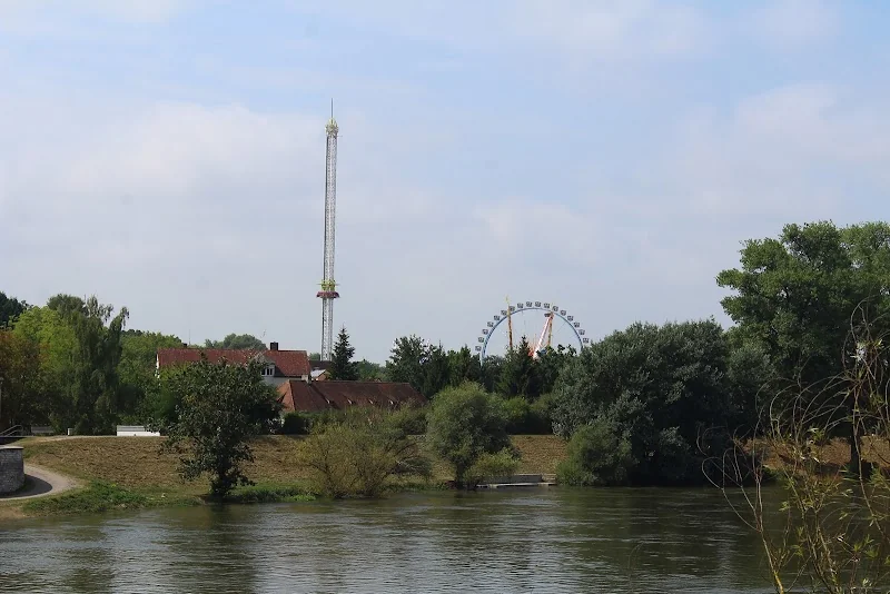
The immediate context is also typical for Straubing: The ducal castle is close enough that the Schloßbrücke appears as a reference point in many city tours and paths, and the riverbank area at Gstütt offers a contrast between urban density and green river landscape. The city describes the surroundings of Gstütt with its park-like plantings since the 1950s as a consciously designed recreational area, without losing sight relationships to the Bavarian Forest or the city of Straubing. This explains why the Schloßbrücke is so much more than a mere crossing: It is a transition between two spatial qualities. On one side stands the Old Town with its historic facades, sightlines, and public buildings. On the other side, the Danube and floodplain area opens up with green spaces, river structures, and the transition to Gstütt. This combination makes the location particularly valuable for visitors who want to understand Straubing in just a few steps. ([straubing.de](https://www.straubing.de/leben/umwelt/natur/landschaftselemente/3916.Gstuett--Vogelau.html))
History of the Danube Connection and Shipping
Historically, the Schloßbrücke is particularly exciting because its location reflects the old Danube economy of Straubing. In the urban historical representation of shipping on the Straubing Danube, it is described that downstream ships had to dock at a landing stage above the confluence of the Moosmühlgraben, while for the return journey, the landing site was located below the Schloßbrücke at Gstütt. There, the cargo was checked, and the toll was paid. This shows how important this section of the river was for trade, control, and traffic. In the Middle Ages, Straubing was not only a city on the Danube but a place where traffic flows, customs, and transshipment came together. The Schloßbrücke thus symbolizes a piece of city history that is closely linked to the economic life of the Danube. Today, the area at Gstütt serves different purposes, but the historical function is still discernible: Today, there is a small protected harbor used by the Straubing branch of the Waterways and Shipping Office Regensburg as an operating harbor, and opposite are the docks designated for passenger shipping. ([straubing.de](https://www.straubing.de/entdecken-erleben/wissens-und-sehenswertes/geschichtsweg/3264.Historische-Schifffahrt-auf-der-Straubinger-Donau.html))
This historical depth fits Straubing as a whole, as the city repeatedly refers in its city portrait and historical overviews to its long development from the early settlement core to the new city of 1218 and later the residence and administrative city. Although the Schloßbrücke is not documented with an exact year of construction in the sources evaluated here, its location tells a story that is much older than today's road traffic. The Danube was a transport route, an economic lifeline, and an urban boundary at the same time in Straubing. In connection with the ducal castle, the salt store, and the river facilities, an ensemble emerges that shapes the character of the Gäuboden city. Therefore, when visiting the Schloßbrücke, one stands at a place where not only water and road meet but also medieval trade logic, princely urban development, and modern use overlap. This historical layering makes the bridge particularly attractive for culture-interested visitors. ([straubing.de](https://www.straubing.de/entdecken-erleben/wissens-und-sehenswertes/historieundstadtwappen/190.Die-Straubinger-Historie.html?utm_source=openai))
Access, Parking, and Traffic at the Schloßbrücke
For practical planning, it is important to note that the Schloßbrücke is located in a heavily frequented city center area. The urban traffic study for the junction Schloßbrücke/Uferstraße/Stadtgraben/Schloßplatz describes the area as a shifted junction with turning lanes on the access to the Schloßbrücke and Uferstraße. At the same time, it is noted that the signal system reaches its capacity limits during peak hours and is temporarily overloaded. This is not a negative feature for a visit, but rather a hint that one should expect inner-city traffic around the bridge. However, for pedestrians and cyclists, the existing fords and crossings are a clear advantage, as one can meaningfully incorporate the bridge into a city walk without a car. Those arriving by car should not underestimate the traffic guidance but also not overestimate it: It is a lively city center environment with several target groups, not an isolated transit point. ([straubing.de](https://www.straubing.de/media/www.straubing.de/org/med_3719/6776_235_bg_anl_12.5_verkehrsuntersuchung.pdf))
Straubing generally offers good parking options. The city refers to around 1,100 parking spaces in the city center, which are accessed via a parking guidance system. Additionally, the free large parking lot Am Hagen is highlighted, which serves as an important parking area outside of the folk festival season. There are also bus parking spaces available, and the Hagen has been a central place for events and parking in the city's history as well as in today's everyday life. For visitors to the Schloßbrücke, this is practical: Those who want to explore the Old Town, the ducal castle, and the river areas can often park their car on the outskirts of the center and walk the rest. This is, in my view, the most sensible approach, as the surroundings of the Schloßbrücke are best understood through short paths and changes of perspective. Those who prefer to come by bus or as part of a guided tour also benefit from the good accessibility of the city center and the proximity to the central stops and parking areas. ([straubing.de](https://www.straubing.de/leben/mobilitaet/parken-in-straubing/index.html?utm_source=openai))
Even during larger events, the location remains well integrated. The city points out that at the large parking lot Am Hagen, alternative and shuttle bus solutions are used at certain times. This shows that the entire city center around Schloßbrücke, Schloßplatz, and Old Town is understood as a cohesive visitor area. For targeted access, therefore, less a single parking address is decisive than the question of whether one wants to use the center as a pedestrian zone, for a short crossing, or for a longer walk. Those who want to photograph the Schloßbrücke, view the Danube, or continue towards the ducal castle should get as close to the city center as possible, park where the parking guidance system indicates free spaces, and use the paths between Schloßplatz, Uferstraße, and Gstütt on foot. This way, the bridge does not become a traffic topic but a starting point for a pleasant city walk. ([straubing.de](https://www.straubing.de/leben/mobilitaet/parken-in-straubing/index.html?utm_source=openai))
On Foot and by Bike Across the Danube
The Schloßbrücke is particularly well-suited for visitors who want to experience Straubing actively. The official traffic study explicitly mentions fords for pedestrians and cyclists over the arms of the Schloßbrücke, Stadtgraben, and Uferstraße. This means: The area is not only geared towards car traffic but also towards people who want to explore the city on foot or by bike. This fits well with the fact that Straubing offers several services in the area of cycling, including bed & bike accommodations, e-bike charging stations, and a bike rental system. For visiting the bridge and the adjacent Danube banks, this is ideal, as it creates a natural combination of city, movement, and views. The tourism information is also geared towards cyclists and refers to information offers on Fraunhoferstraße. So, those coming through the city center by bike can easily incorporate the Schloßbrücke into a round along the Danube, thus connecting the Old Town and the river area. ([straubing.de](https://www.straubing.de/media/www.straubing.de/org/med_3719/6776_235_bg_anl_12.5_verkehrsuntersuchung.pdf))
Additionally, the surrounding landscape supports the walking experience. The Gstütt island has been park-like designed since the 1950s according to the city's nature description and has been consciously developed as a recreational area, without losing sight of the Bavarian Forest or the city. The Danube floodplain with its side waters and former river bends provides a high density of biotopes and microhabitats, making the path over or along the Schloßbrücke not only urban but also landscape interesting. Especially in the transition between stone, water, and green, a pleasant image emerges for short breaks, photo stops, and quiet moments by the river. Those who want to experience the area as part of a larger round can combine the bridge with the Danube paths, the Old Town, and the river areas. This turns a simple crossing into a small city walk that is suitable for visitors with little time as well as for guests who want to explore Straubing more intensively. ([straubing.de](https://www.straubing.de/leben/umwelt/natur/landschaftselemente/3916.Gstuett--Vogelau.html))
Ducal Castle, Salt Store, and City Tours Within Reach
One of the biggest advantages of the Schloßbrücke is its proximity to the most important sights of Straubing. The former ducal castle is in the immediate vicinity and is described by the city as the former princely building on the Danube, which was established in 1356 as the Lower Bavarian residence of the Duchy of Bavaria-Straubing-Holland. The knights' hall in the ducal castle is one of the largest and best-preserved medieval banquet halls in Germany, with around 400 square meters. Today, the castle houses, among other things, the tax office, while the city library and city archive are located in the salt store. Additionally, the courtyard of the ducal castle is the venue for the Agnes Bernauer Festival every four years. For visitors to the Schloßbrücke, this means: Few other places in Straubing bundle so many historical references in such a small space. The bridge is thus an ideal starting point if one wants not only to overview the city but truly understand it. ([straubing.de](https://www.straubing.de/entdecken-erleben/wissens-und-sehenswertes/sehenswuerdigkeiten/236.Das-ehemalige-Herzogsschloss.html))
The tourist mediation is also directly aimed at this urban space. In the city tours, the meeting point at the entrance of the ducal castle is explicitly indicated with the note “Near Schloßbrücke.” This is a strong sign of how central the bridge is anchored in the cityscape. From there, historical walks, river paths, and city core walks can be well connected. The city tours address topics such as the Duchy of Bavaria-Straubing-Holland, the city's heyday, the development of the Old Town, and the perception of Straubing as a historically significant residence and administrative city. Therefore, those starting near the Schloßbrücke immediately connect to the most important cultural sites of the city. This makes the location particularly attractive for guests seeking a concentrated and content-rich impression of Straubing. Here, river, castle, urban architecture, and city history converge, and it is precisely this proximity that creates the actual charm of the place. ([straubing.de](https://www.straubing.de/media/www.straubing.de/org/med_1957/7095_stadtfuehrungen_2025.pdf))
Gstütt-Vogelau, View and Green Space at the Danube
The landscape framework of the Schloßbrücke is at least as important as its traffic function. The city describes the Gstütt-Vogelau area as part of the Danube floodplain with numerous side waters and former river bends, which generate a high density of biotopes and microhabitats. Particularly noteworthy is that the riverbanks of the Danube and the wooded areas of the Gstütt island are considered protected landscape components and, together with water areas and meadows, are part of the EU's Natura2000 protected area network. Additionally, ecological values such as the recorded bird, butterfly, dragonfly, grasshopper, and amphibian species are present. For visitors, this means: Around the Schloßbrücke, one experiences not only an inner-city river crossing but also a space of nature conservation significance. Especially because the bridge mediates between built urban space and protected riverbank area, the location acquires a special atmosphere. The Danube appears here not as a fringe zone but as a shaping component of the urban experience. ([straubing.de](https://www.straubing.de/leben/umwelt/natur/landschaftselemente/3916.Gstuett--Vogelau.html))
The design development also contributes to this impression. Since the 1950s, the landscape appearance of Gstütt has been characterized by park-like plantings that have been deliberately created as a recreational area. The city emphasizes that the sight relationships to the Bavarian Forest and the city of Straubing should be preserved. This openness makes the area around the Schloßbrücke so pleasant: One stands close to the water but simultaneously has an unobstructed view of the city and landscape. This is ideal for photos, short breaks, or a quiet moment between the Old Town and the river. When considering the Schloßbrücke as a location for a walk, a short break, or as part of a larger tour, this mix of urban clarity and green expansiveness is crucial. The bridge is thus not only a traffic structure but also a viewpoint in a broader sense, as it makes Straubing's relationship with the Danube particularly visible. ([straubing.de](https://www.straubing.de/leben/umwelt/natur/landschaftselemente/3916.Gstuett--Vogelau.html))
Sources:
Mehr anzeigenWeniger anzeigen
Schloßbrücke Straubing | Danube & Old Town
The Schloßbrücke in Straubing is a place where city history, river landscape, and everyday paths overlap in a very compact way. As an inner Danube bridge, it connects the Old Town with the inland island Gstütt and is located exactly at the junction where Straubing's historic core, the riverbank zone, and the green space of the Danube meet. This is particularly appealing to visitors because here one not only crosses a bridge but enters a cityscape characterized by the ducal castle, the Danube, ship docks, park-like areas, and striking sightlines. The location at the junction of Schloßbrücke/Uferstraße/Stadtgraben/Schloßplatz also makes the area an important reference point in the inner-city traffic network. Those experiencing Straubing on foot, by bike, or as a city walk often pass by this spot, as it sensibly connects the historic Old Town with the river areas and the paths along the Danube. This blend of function and atmosphere makes the Schloßbrücke an urbanistically interesting, photogenic, and important place for orientation in Straubing. ([de.wikipedia.org](https://de.wikipedia.org/wiki/Schlo%C3%9Fbr%C3%BCcke_%28Straubing%29?utm_source=openai))
Location between Old Town, Uferstraße, and Gstütt
The special quality of the Schloßbrücke lies in its location. It forms the direct connection between the Straubing Old Town and the island Gstütt, which is perceived as a nature-oriented yet urban-integrated area. In the vicinity of the bridge, several axes converge with Schloßplatz, Stadtgraben, and Uferstraße, and it is precisely there that the junction in traffic planning has been described as a shifted developed area with turning lanes. For pedestrians and cyclists, fords over the arms of the Schloßbrücke, Stadtgraben, and Uferstraße are available, making the location relevant not only for car traffic but also for city walks. Particularly interesting is that the area lies within the sightlines of important historical buildings: Urban planning documents explicitly refer to sight relationships from the Schloßbrücke to the towers of St. Peter's Church. This makes it clear that the bridge is not merely a technical structure but part of the historical cityscape that shapes the perception of the Old Town. Standing here, one experiences the Danube as a spatial boundary and at the same time as a connecting element between the urban spaces. ([straubing.de](https://www.straubing.de/media/www.straubing.de/org/med_3719/6776_235_bg_anl_12.5_verkehrsuntersuchung.pdf))
The immediate context is also typical for Straubing: The ducal castle is close enough that the Schloßbrücke appears as a reference point in many city tours and paths, and the riverbank area at Gstütt offers a contrast between urban density and green river landscape. The city describes the surroundings of Gstütt with its park-like plantings since the 1950s as a consciously designed recreational area, without losing sight relationships to the Bavarian Forest or the city of Straubing. This explains why the Schloßbrücke is so much more than a mere crossing: It is a transition between two spatial qualities. On one side stands the Old Town with its historic facades, sightlines, and public buildings. On the other side, the Danube and floodplain area opens up with green spaces, river structures, and the transition to Gstütt. This combination makes the location particularly valuable for visitors who want to understand Straubing in just a few steps. ([straubing.de](https://www.straubing.de/leben/umwelt/natur/landschaftselemente/3916.Gstuett--Vogelau.html))
History of the Danube Connection and Shipping
Historically, the Schloßbrücke is particularly exciting because its location reflects the old Danube economy of Straubing. In the urban historical representation of shipping on the Straubing Danube, it is described that downstream ships had to dock at a landing stage above the confluence of the Moosmühlgraben, while for the return journey, the landing site was located below the Schloßbrücke at Gstütt. There, the cargo was checked, and the toll was paid. This shows how important this section of the river was for trade, control, and traffic. In the Middle Ages, Straubing was not only a city on the Danube but a place where traffic flows, customs, and transshipment came together. The Schloßbrücke thus symbolizes a piece of city history that is closely linked to the economic life of the Danube. Today, the area at Gstütt serves different purposes, but the historical function is still discernible: Today, there is a small protected harbor used by the Straubing branch of the Waterways and Shipping Office Regensburg as an operating harbor, and opposite are the docks designated for passenger shipping. ([straubing.de](https://www.straubing.de/entdecken-erleben/wissens-und-sehenswertes/geschichtsweg/3264.Historische-Schifffahrt-auf-der-Straubinger-Donau.html))
This historical depth fits Straubing as a whole, as the city repeatedly refers in its city portrait and historical overviews to its long development from the early settlement core to the new city of 1218 and later the residence and administrative city. Although the Schloßbrücke is not documented with an exact year of construction in the sources evaluated here, its location tells a story that is much older than today's road traffic. The Danube was a transport route, an economic lifeline, and an urban boundary at the same time in Straubing. In connection with the ducal castle, the salt store, and the river facilities, an ensemble emerges that shapes the character of the Gäuboden city. Therefore, when visiting the Schloßbrücke, one stands at a place where not only water and road meet but also medieval trade logic, princely urban development, and modern use overlap. This historical layering makes the bridge particularly attractive for culture-interested visitors. ([straubing.de](https://www.straubing.de/entdecken-erleben/wissens-und-sehenswertes/historieundstadtwappen/190.Die-Straubinger-Historie.html?utm_source=openai))
Access, Parking, and Traffic at the Schloßbrücke
For practical planning, it is important to note that the Schloßbrücke is located in a heavily frequented city center area. The urban traffic study for the junction Schloßbrücke/Uferstraße/Stadtgraben/Schloßplatz describes the area as a shifted junction with turning lanes on the access to the Schloßbrücke and Uferstraße. At the same time, it is noted that the signal system reaches its capacity limits during peak hours and is temporarily overloaded. This is not a negative feature for a visit, but rather a hint that one should expect inner-city traffic around the bridge. However, for pedestrians and cyclists, the existing fords and crossings are a clear advantage, as one can meaningfully incorporate the bridge into a city walk without a car. Those arriving by car should not underestimate the traffic guidance but also not overestimate it: It is a lively city center environment with several target groups, not an isolated transit point. ([straubing.de](https://www.straubing.de/media/www.straubing.de/org/med_3719/6776_235_bg_anl_12.5_verkehrsuntersuchung.pdf))
Straubing generally offers good parking options. The city refers to around 1,100 parking spaces in the city center, which are accessed via a parking guidance system. Additionally, the free large parking lot Am Hagen is highlighted, which serves as an important parking area outside of the folk festival season. There are also bus parking spaces available, and the Hagen has been a central place for events and parking in the city's history as well as in today's everyday life. For visitors to the Schloßbrücke, this is practical: Those who want to explore the Old Town, the ducal castle, and the river areas can often park their car on the outskirts of the center and walk the rest. This is, in my view, the most sensible approach, as the surroundings of the Schloßbrücke are best understood through short paths and changes of perspective. Those who prefer to come by bus or as part of a guided tour also benefit from the good accessibility of the city center and the proximity to the central stops and parking areas. ([straubing.de](https://www.straubing.de/leben/mobilitaet/parken-in-straubing/index.html?utm_source=openai))
Even during larger events, the location remains well integrated. The city points out that at the large parking lot Am Hagen, alternative and shuttle bus solutions are used at certain times. This shows that the entire city center around Schloßbrücke, Schloßplatz, and Old Town is understood as a cohesive visitor area. For targeted access, therefore, less a single parking address is decisive than the question of whether one wants to use the center as a pedestrian zone, for a short crossing, or for a longer walk. Those who want to photograph the Schloßbrücke, view the Danube, or continue towards the ducal castle should get as close to the city center as possible, park where the parking guidance system indicates free spaces, and use the paths between Schloßplatz, Uferstraße, and Gstütt on foot. This way, the bridge does not become a traffic topic but a starting point for a pleasant city walk. ([straubing.de](https://www.straubing.de/leben/mobilitaet/parken-in-straubing/index.html?utm_source=openai))
On Foot and by Bike Across the Danube
The Schloßbrücke is particularly well-suited for visitors who want to experience Straubing actively. The official traffic study explicitly mentions fords for pedestrians and cyclists over the arms of the Schloßbrücke, Stadtgraben, and Uferstraße. This means: The area is not only geared towards car traffic but also towards people who want to explore the city on foot or by bike. This fits well with the fact that Straubing offers several services in the area of cycling, including bed & bike accommodations, e-bike charging stations, and a bike rental system. For visiting the bridge and the adjacent Danube banks, this is ideal, as it creates a natural combination of city, movement, and views. The tourism information is also geared towards cyclists and refers to information offers on Fraunhoferstraße. So, those coming through the city center by bike can easily incorporate the Schloßbrücke into a round along the Danube, thus connecting the Old Town and the river area. ([straubing.de](https://www.straubing.de/media/www.straubing.de/org/med_3719/6776_235_bg_anl_12.5_verkehrsuntersuchung.pdf))
Additionally, the surrounding landscape supports the walking experience. The Gstütt island has been park-like designed since the 1950s according to the city's nature description and has been consciously developed as a recreational area, without losing sight of the Bavarian Forest or the city. The Danube floodplain with its side waters and former river bends provides a high density of biotopes and microhabitats, making the path over or along the Schloßbrücke not only urban but also landscape interesting. Especially in the transition between stone, water, and green, a pleasant image emerges for short breaks, photo stops, and quiet moments by the river. Those who want to experience the area as part of a larger round can combine the bridge with the Danube paths, the Old Town, and the river areas. This turns a simple crossing into a small city walk that is suitable for visitors with little time as well as for guests who want to explore Straubing more intensively. ([straubing.de](https://www.straubing.de/leben/umwelt/natur/landschaftselemente/3916.Gstuett--Vogelau.html))
Ducal Castle, Salt Store, and City Tours Within Reach
One of the biggest advantages of the Schloßbrücke is its proximity to the most important sights of Straubing. The former ducal castle is in the immediate vicinity and is described by the city as the former princely building on the Danube, which was established in 1356 as the Lower Bavarian residence of the Duchy of Bavaria-Straubing-Holland. The knights' hall in the ducal castle is one of the largest and best-preserved medieval banquet halls in Germany, with around 400 square meters. Today, the castle houses, among other things, the tax office, while the city library and city archive are located in the salt store. Additionally, the courtyard of the ducal castle is the venue for the Agnes Bernauer Festival every four years. For visitors to the Schloßbrücke, this means: Few other places in Straubing bundle so many historical references in such a small space. The bridge is thus an ideal starting point if one wants not only to overview the city but truly understand it. ([straubing.de](https://www.straubing.de/entdecken-erleben/wissens-und-sehenswertes/sehenswuerdigkeiten/236.Das-ehemalige-Herzogsschloss.html))
The tourist mediation is also directly aimed at this urban space. In the city tours, the meeting point at the entrance of the ducal castle is explicitly indicated with the note “Near Schloßbrücke.” This is a strong sign of how central the bridge is anchored in the cityscape. From there, historical walks, river paths, and city core walks can be well connected. The city tours address topics such as the Duchy of Bavaria-Straubing-Holland, the city's heyday, the development of the Old Town, and the perception of Straubing as a historically significant residence and administrative city. Therefore, those starting near the Schloßbrücke immediately connect to the most important cultural sites of the city. This makes the location particularly attractive for guests seeking a concentrated and content-rich impression of Straubing. Here, river, castle, urban architecture, and city history converge, and it is precisely this proximity that creates the actual charm of the place. ([straubing.de](https://www.straubing.de/media/www.straubing.de/org/med_1957/7095_stadtfuehrungen_2025.pdf))
Gstütt-Vogelau, View and Green Space at the Danube
The landscape framework of the Schloßbrücke is at least as important as its traffic function. The city describes the Gstütt-Vogelau area as part of the Danube floodplain with numerous side waters and former river bends, which generate a high density of biotopes and microhabitats. Particularly noteworthy is that the riverbanks of the Danube and the wooded areas of the Gstütt island are considered protected landscape components and, together with water areas and meadows, are part of the EU's Natura2000 protected area network. Additionally, ecological values such as the recorded bird, butterfly, dragonfly, grasshopper, and amphibian species are present. For visitors, this means: Around the Schloßbrücke, one experiences not only an inner-city river crossing but also a space of nature conservation significance. Especially because the bridge mediates between built urban space and protected riverbank area, the location acquires a special atmosphere. The Danube appears here not as a fringe zone but as a shaping component of the urban experience. ([straubing.de](https://www.straubing.de/leben/umwelt/natur/landschaftselemente/3916.Gstuett--Vogelau.html))
The design development also contributes to this impression. Since the 1950s, the landscape appearance of Gstütt has been characterized by park-like plantings that have been deliberately created as a recreational area. The city emphasizes that the sight relationships to the Bavarian Forest and the city of Straubing should be preserved. This openness makes the area around the Schloßbrücke so pleasant: One stands close to the water but simultaneously has an unobstructed view of the city and landscape. This is ideal for photos, short breaks, or a quiet moment between the Old Town and the river. When considering the Schloßbrücke as a location for a walk, a short break, or as part of a larger tour, this mix of urban clarity and green expansiveness is crucial. The bridge is thus not only a traffic structure but also a viewpoint in a broader sense, as it makes Straubing's relationship with the Danube particularly visible. ([straubing.de](https://www.straubing.de/leben/umwelt/natur/landschaftselemente/3916.Gstuett--Vogelau.html))
Sources:
Schloßbrücke Straubing | Danube & Old Town
The Schloßbrücke in Straubing is a place where city history, river landscape, and everyday paths overlap in a very compact way. As an inner Danube bridge, it connects the Old Town with the inland island Gstütt and is located exactly at the junction where Straubing's historic core, the riverbank zone, and the green space of the Danube meet. This is particularly appealing to visitors because here one not only crosses a bridge but enters a cityscape characterized by the ducal castle, the Danube, ship docks, park-like areas, and striking sightlines. The location at the junction of Schloßbrücke/Uferstraße/Stadtgraben/Schloßplatz also makes the area an important reference point in the inner-city traffic network. Those experiencing Straubing on foot, by bike, or as a city walk often pass by this spot, as it sensibly connects the historic Old Town with the river areas and the paths along the Danube. This blend of function and atmosphere makes the Schloßbrücke an urbanistically interesting, photogenic, and important place for orientation in Straubing. ([de.wikipedia.org](https://de.wikipedia.org/wiki/Schlo%C3%9Fbr%C3%BCcke_%28Straubing%29?utm_source=openai))
Location between Old Town, Uferstraße, and Gstütt
The special quality of the Schloßbrücke lies in its location. It forms the direct connection between the Straubing Old Town and the island Gstütt, which is perceived as a nature-oriented yet urban-integrated area. In the vicinity of the bridge, several axes converge with Schloßplatz, Stadtgraben, and Uferstraße, and it is precisely there that the junction in traffic planning has been described as a shifted developed area with turning lanes. For pedestrians and cyclists, fords over the arms of the Schloßbrücke, Stadtgraben, and Uferstraße are available, making the location relevant not only for car traffic but also for city walks. Particularly interesting is that the area lies within the sightlines of important historical buildings: Urban planning documents explicitly refer to sight relationships from the Schloßbrücke to the towers of St. Peter's Church. This makes it clear that the bridge is not merely a technical structure but part of the historical cityscape that shapes the perception of the Old Town. Standing here, one experiences the Danube as a spatial boundary and at the same time as a connecting element between the urban spaces. ([straubing.de](https://www.straubing.de/media/www.straubing.de/org/med_3719/6776_235_bg_anl_12.5_verkehrsuntersuchung.pdf))
The immediate context is also typical for Straubing: The ducal castle is close enough that the Schloßbrücke appears as a reference point in many city tours and paths, and the riverbank area at Gstütt offers a contrast between urban density and green river landscape. The city describes the surroundings of Gstütt with its park-like plantings since the 1950s as a consciously designed recreational area, without losing sight relationships to the Bavarian Forest or the city of Straubing. This explains why the Schloßbrücke is so much more than a mere crossing: It is a transition between two spatial qualities. On one side stands the Old Town with its historic facades, sightlines, and public buildings. On the other side, the Danube and floodplain area opens up with green spaces, river structures, and the transition to Gstütt. This combination makes the location particularly valuable for visitors who want to understand Straubing in just a few steps. ([straubing.de](https://www.straubing.de/leben/umwelt/natur/landschaftselemente/3916.Gstuett--Vogelau.html))
History of the Danube Connection and Shipping
Historically, the Schloßbrücke is particularly exciting because its location reflects the old Danube economy of Straubing. In the urban historical representation of shipping on the Straubing Danube, it is described that downstream ships had to dock at a landing stage above the confluence of the Moosmühlgraben, while for the return journey, the landing site was located below the Schloßbrücke at Gstütt. There, the cargo was checked, and the toll was paid. This shows how important this section of the river was for trade, control, and traffic. In the Middle Ages, Straubing was not only a city on the Danube but a place where traffic flows, customs, and transshipment came together. The Schloßbrücke thus symbolizes a piece of city history that is closely linked to the economic life of the Danube. Today, the area at Gstütt serves different purposes, but the historical function is still discernible: Today, there is a small protected harbor used by the Straubing branch of the Waterways and Shipping Office Regensburg as an operating harbor, and opposite are the docks designated for passenger shipping. ([straubing.de](https://www.straubing.de/entdecken-erleben/wissens-und-sehenswertes/geschichtsweg/3264.Historische-Schifffahrt-auf-der-Straubinger-Donau.html))
This historical depth fits Straubing as a whole, as the city repeatedly refers in its city portrait and historical overviews to its long development from the early settlement core to the new city of 1218 and later the residence and administrative city. Although the Schloßbrücke is not documented with an exact year of construction in the sources evaluated here, its location tells a story that is much older than today's road traffic. The Danube was a transport route, an economic lifeline, and an urban boundary at the same time in Straubing. In connection with the ducal castle, the salt store, and the river facilities, an ensemble emerges that shapes the character of the Gäuboden city. Therefore, when visiting the Schloßbrücke, one stands at a place where not only water and road meet but also medieval trade logic, princely urban development, and modern use overlap. This historical layering makes the bridge particularly attractive for culture-interested visitors. ([straubing.de](https://www.straubing.de/entdecken-erleben/wissens-und-sehenswertes/historieundstadtwappen/190.Die-Straubinger-Historie.html?utm_source=openai))
Access, Parking, and Traffic at the Schloßbrücke
For practical planning, it is important to note that the Schloßbrücke is located in a heavily frequented city center area. The urban traffic study for the junction Schloßbrücke/Uferstraße/Stadtgraben/Schloßplatz describes the area as a shifted junction with turning lanes on the access to the Schloßbrücke and Uferstraße. At the same time, it is noted that the signal system reaches its capacity limits during peak hours and is temporarily overloaded. This is not a negative feature for a visit, but rather a hint that one should expect inner-city traffic around the bridge. However, for pedestrians and cyclists, the existing fords and crossings are a clear advantage, as one can meaningfully incorporate the bridge into a city walk without a car. Those arriving by car should not underestimate the traffic guidance but also not overestimate it: It is a lively city center environment with several target groups, not an isolated transit point. ([straubing.de](https://www.straubing.de/media/www.straubing.de/org/med_3719/6776_235_bg_anl_12.5_verkehrsuntersuchung.pdf))
Straubing generally offers good parking options. The city refers to around 1,100 parking spaces in the city center, which are accessed via a parking guidance system. Additionally, the free large parking lot Am Hagen is highlighted, which serves as an important parking area outside of the folk festival season. There are also bus parking spaces available, and the Hagen has been a central place for events and parking in the city's history as well as in today's everyday life. For visitors to the Schloßbrücke, this is practical: Those who want to explore the Old Town, the ducal castle, and the river areas can often park their car on the outskirts of the center and walk the rest. This is, in my view, the most sensible approach, as the surroundings of the Schloßbrücke are best understood through short paths and changes of perspective. Those who prefer to come by bus or as part of a guided tour also benefit from the good accessibility of the city center and the proximity to the central stops and parking areas. ([straubing.de](https://www.straubing.de/leben/mobilitaet/parken-in-straubing/index.html?utm_source=openai))
Even during larger events, the location remains well integrated. The city points out that at the large parking lot Am Hagen, alternative and shuttle bus solutions are used at certain times. This shows that the entire city center around Schloßbrücke, Schloßplatz, and Old Town is understood as a cohesive visitor area. For targeted access, therefore, less a single parking address is decisive than the question of whether one wants to use the center as a pedestrian zone, for a short crossing, or for a longer walk. Those who want to photograph the Schloßbrücke, view the Danube, or continue towards the ducal castle should get as close to the city center as possible, park where the parking guidance system indicates free spaces, and use the paths between Schloßplatz, Uferstraße, and Gstütt on foot. This way, the bridge does not become a traffic topic but a starting point for a pleasant city walk. ([straubing.de](https://www.straubing.de/leben/mobilitaet/parken-in-straubing/index.html?utm_source=openai))
On Foot and by Bike Across the Danube
The Schloßbrücke is particularly well-suited for visitors who want to experience Straubing actively. The official traffic study explicitly mentions fords for pedestrians and cyclists over the arms of the Schloßbrücke, Stadtgraben, and Uferstraße. This means: The area is not only geared towards car traffic but also towards people who want to explore the city on foot or by bike. This fits well with the fact that Straubing offers several services in the area of cycling, including bed & bike accommodations, e-bike charging stations, and a bike rental system. For visiting the bridge and the adjacent Danube banks, this is ideal, as it creates a natural combination of city, movement, and views. The tourism information is also geared towards cyclists and refers to information offers on Fraunhoferstraße. So, those coming through the city center by bike can easily incorporate the Schloßbrücke into a round along the Danube, thus connecting the Old Town and the river area. ([straubing.de](https://www.straubing.de/media/www.straubing.de/org/med_3719/6776_235_bg_anl_12.5_verkehrsuntersuchung.pdf))
Additionally, the surrounding landscape supports the walking experience. The Gstütt island has been park-like designed since the 1950s according to the city's nature description and has been consciously developed as a recreational area, without losing sight of the Bavarian Forest or the city. The Danube floodplain with its side waters and former river bends provides a high density of biotopes and microhabitats, making the path over or along the Schloßbrücke not only urban but also landscape interesting. Especially in the transition between stone, water, and green, a pleasant image emerges for short breaks, photo stops, and quiet moments by the river. Those who want to experience the area as part of a larger round can combine the bridge with the Danube paths, the Old Town, and the river areas. This turns a simple crossing into a small city walk that is suitable for visitors with little time as well as for guests who want to explore Straubing more intensively. ([straubing.de](https://www.straubing.de/leben/umwelt/natur/landschaftselemente/3916.Gstuett--Vogelau.html))
Ducal Castle, Salt Store, and City Tours Within Reach
One of the biggest advantages of the Schloßbrücke is its proximity to the most important sights of Straubing. The former ducal castle is in the immediate vicinity and is described by the city as the former princely building on the Danube, which was established in 1356 as the Lower Bavarian residence of the Duchy of Bavaria-Straubing-Holland. The knights' hall in the ducal castle is one of the largest and best-preserved medieval banquet halls in Germany, with around 400 square meters. Today, the castle houses, among other things, the tax office, while the city library and city archive are located in the salt store. Additionally, the courtyard of the ducal castle is the venue for the Agnes Bernauer Festival every four years. For visitors to the Schloßbrücke, this means: Few other places in Straubing bundle so many historical references in such a small space. The bridge is thus an ideal starting point if one wants not only to overview the city but truly understand it. ([straubing.de](https://www.straubing.de/entdecken-erleben/wissens-und-sehenswertes/sehenswuerdigkeiten/236.Das-ehemalige-Herzogsschloss.html))
The tourist mediation is also directly aimed at this urban space. In the city tours, the meeting point at the entrance of the ducal castle is explicitly indicated with the note “Near Schloßbrücke.” This is a strong sign of how central the bridge is anchored in the cityscape. From there, historical walks, river paths, and city core walks can be well connected. The city tours address topics such as the Duchy of Bavaria-Straubing-Holland, the city's heyday, the development of the Old Town, and the perception of Straubing as a historically significant residence and administrative city. Therefore, those starting near the Schloßbrücke immediately connect to the most important cultural sites of the city. This makes the location particularly attractive for guests seeking a concentrated and content-rich impression of Straubing. Here, river, castle, urban architecture, and city history converge, and it is precisely this proximity that creates the actual charm of the place. ([straubing.de](https://www.straubing.de/media/www.straubing.de/org/med_1957/7095_stadtfuehrungen_2025.pdf))
Gstütt-Vogelau, View and Green Space at the Danube
The landscape framework of the Schloßbrücke is at least as important as its traffic function. The city describes the Gstütt-Vogelau area as part of the Danube floodplain with numerous side waters and former river bends, which generate a high density of biotopes and microhabitats. Particularly noteworthy is that the riverbanks of the Danube and the wooded areas of the Gstütt island are considered protected landscape components and, together with water areas and meadows, are part of the EU's Natura2000 protected area network. Additionally, ecological values such as the recorded bird, butterfly, dragonfly, grasshopper, and amphibian species are present. For visitors, this means: Around the Schloßbrücke, one experiences not only an inner-city river crossing but also a space of nature conservation significance. Especially because the bridge mediates between built urban space and protected riverbank area, the location acquires a special atmosphere. The Danube appears here not as a fringe zone but as a shaping component of the urban experience. ([straubing.de](https://www.straubing.de/leben/umwelt/natur/landschaftselemente/3916.Gstuett--Vogelau.html))
The design development also contributes to this impression. Since the 1950s, the landscape appearance of Gstütt has been characterized by park-like plantings that have been deliberately created as a recreational area. The city emphasizes that the sight relationships to the Bavarian Forest and the city of Straubing should be preserved. This openness makes the area around the Schloßbrücke so pleasant: One stands close to the water but simultaneously has an unobstructed view of the city and landscape. This is ideal for photos, short breaks, or a quiet moment between the Old Town and the river. When considering the Schloßbrücke as a location for a walk, a short break, or as part of a larger tour, this mix of urban clarity and green expansiveness is crucial. The bridge is thus not only a traffic structure but also a viewpoint in a broader sense, as it makes Straubing's relationship with the Danube particularly visible. ([straubing.de](https://www.straubing.de/leben/umwelt/natur/landschaftselemente/3916.Gstuett--Vogelau.html))
Sources:
Frequently Asked Questions
Reviews
No reviews found